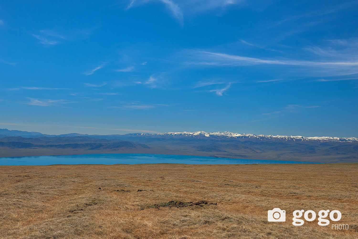
There is a legend that Kheree lake is connected with Uureg lake by land vein, and it is located on the top area of Tsagaan Shuvuut sacred mountain. The origin of the name means to climb a mountain as a local elder told us.
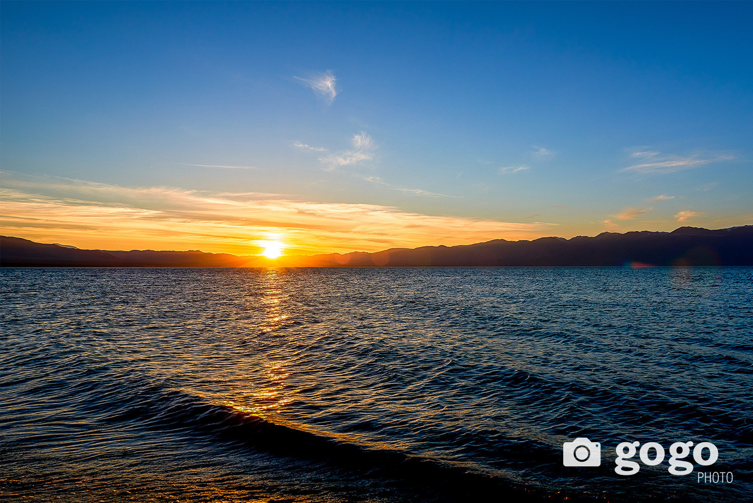
In the early summer of 2013, our team took a photo in Ulgii city, the capital of Bayan-Ulgii province, and arrived late at sunset on the shores of Lake Uureg in Sagil soum, Uvs province.
That night, rays of the golden sun shining on the water mirror of Uureg lake seemed to predict a beautiful day tomorrow and what challenges we would face.
 We visited Batsuuri's family, who was spending the summer on the shore of Uureg lake. Earlier, we heard that there is a lake connected to Uureg lake and located on top of Tsagaan Shuvuut sacred mountain. When I asked about the lake from Batsuuri, he said that he would guide us in the morning to reach there. He also said car UAZ 469 reached Kheree lake 4 years ago and you will be lucky if the mountain road has less damage due to flood. Early in the morning, I took a picture of the rising sun on the shores of Uureg Lake and headed for Kheree Lake.
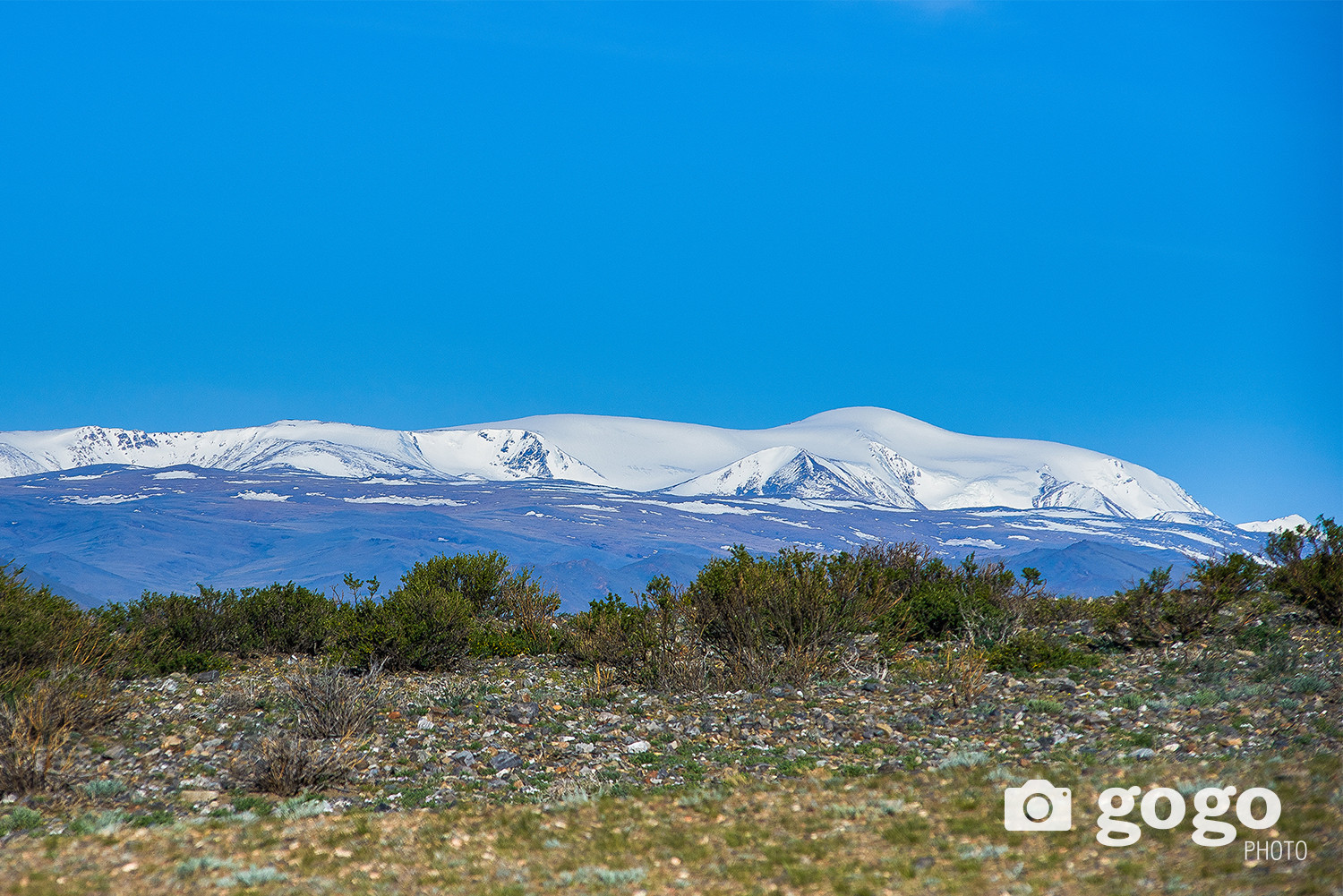
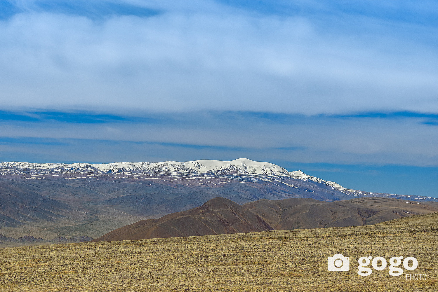
 The Kharig River flows north of Uureg Lake. When the river is flowing steadily, I want to stop for a while in a beautiful place. However, we were trying to get as close as possible to Kheree Lake, which is on a high plateau on Tsagaan Shuvuut Mountain. We also saw majestic snow-peaked mountains, west of the road we were on, the name is Silver Taiga mountain.
It is said that people from Sagil soum of Uvs aimag have been migrating to the area where Silver Taiga mountain is located for a long time. We later heard about this from a local elder, so this time let's postpone mentioning the Silver Taiga.
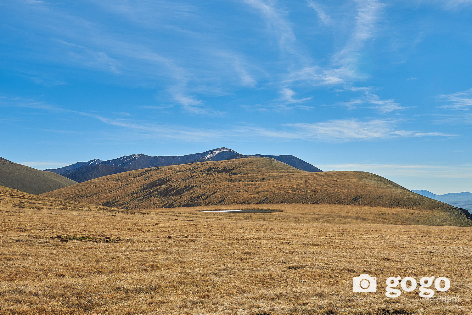
As we continued on, we came to a ravine that flowed down the mountain. By June of this year, there was not much rain or heat, which made it possible to visit Kheree Lake. However, heavy rainfall in previous years has mixed with the melting snow of the snow-peaked mountain, creating a strong flow that has flowed down large boulders along the mountain ravines.
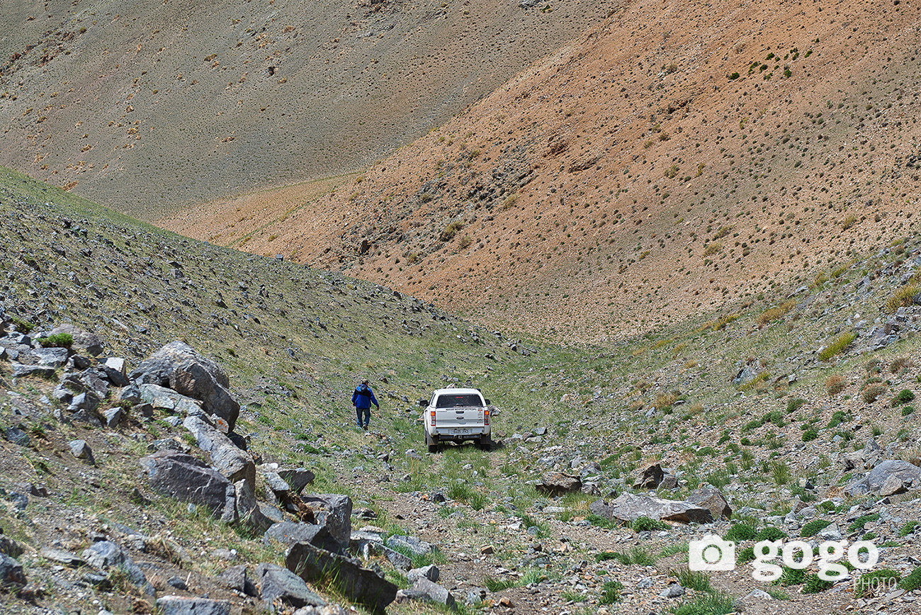
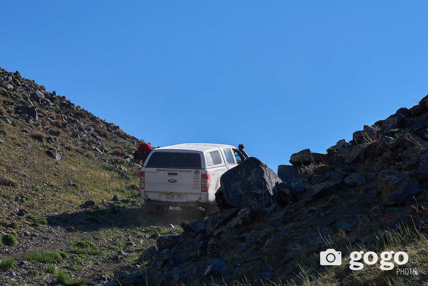
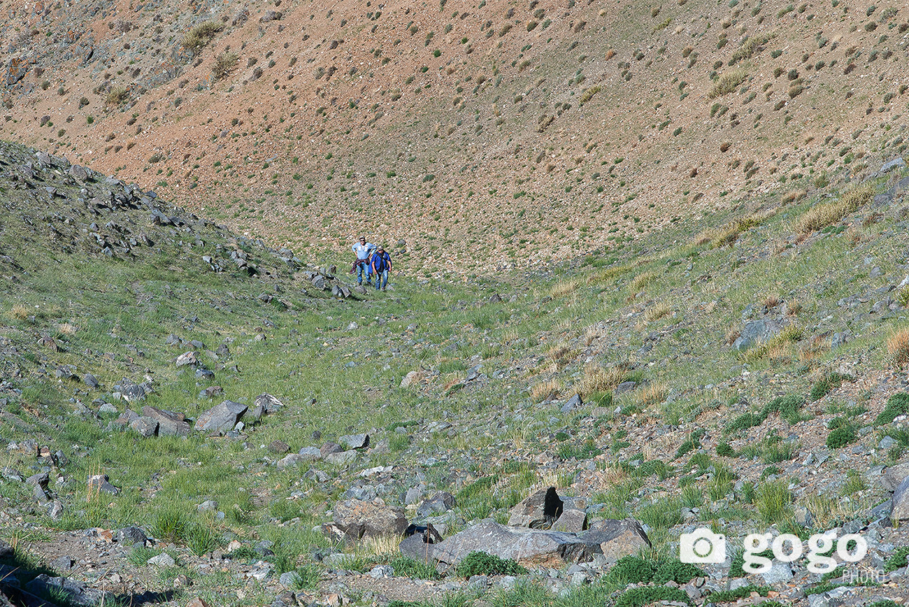
 Some of the ravines were eroded by water and we filled the road with earthworks. This is the only way to reach Kheree Lake. There was no trace of the road, it faded and disappeared. There were also a lot of rocks, which were sharp enough to tear the car's tires. Therefore, team members had to be taken down to ensure safety in some areas.
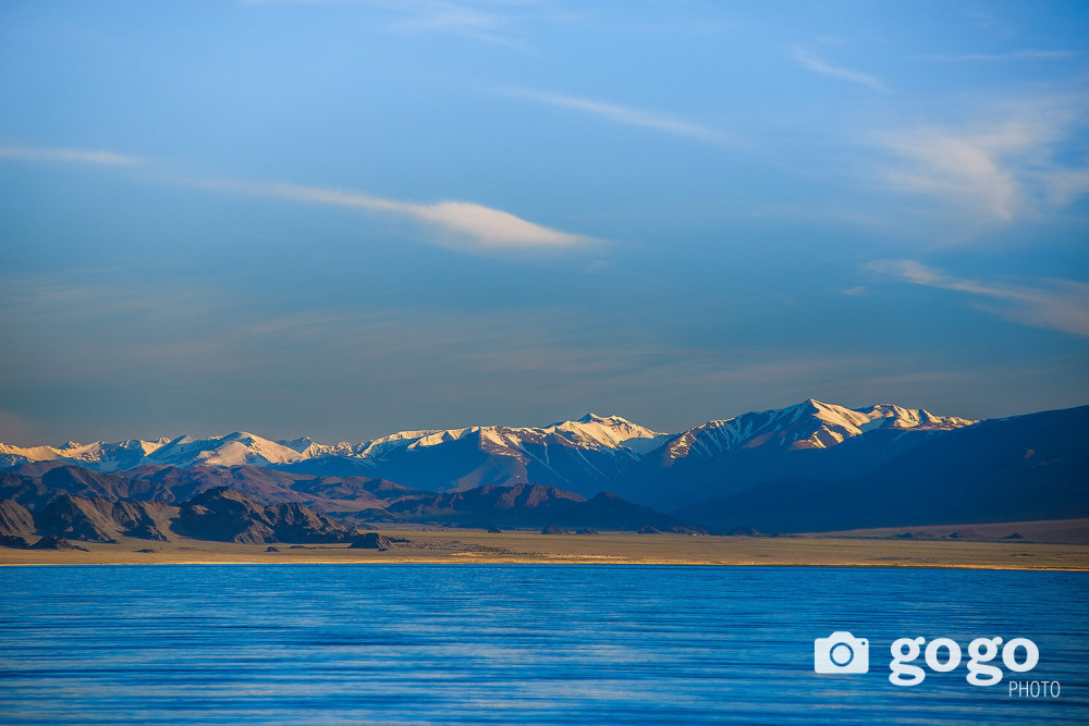
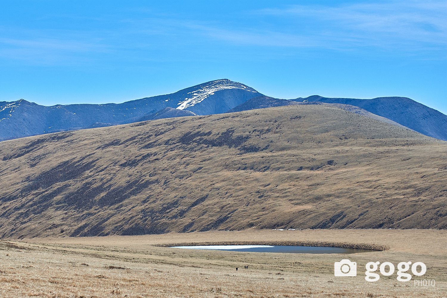
 As we climbed the rocky mountain road, which was 30-45 degrees lane, and we saw Kheree Lake. However it was June, the lake froze into a thin layer of ice during night. It looked small from a distance, but it was a large, round and fresh watered lake when we reached there after walking about 2 kilometers.
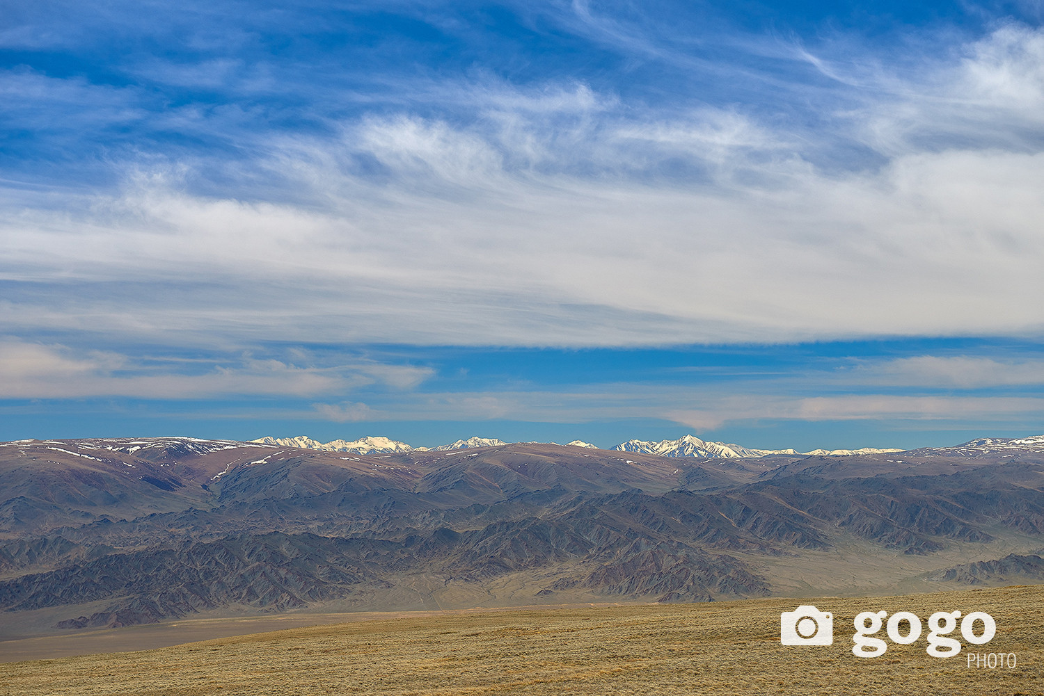
Once we climbed high enough, we were able to see the five peaks of Altai Tavan Bogd mountain, Deglii Tsagaan Mountain, and snow-capped peaks of Kharkhiraa turgen. Also, Silver taiga mountain in Tuva looks really magnificent.
 Tsagaan Shuvuut Khairkhan is rich in wild sheep, ibex, leopard and boar, which is one of the reasons for poachers to come. Batsuuri, who was guiding us, said that it was clear that a leopard was hiding in the middle of the Saalt Khuren Mountain behind the Crow Lake and in the cliffs of the Purshvai ravine.
At an altitude of more than 2,600 meters above sea level, we successfully completed the photo shooting and headed back. Before heading to the lake, the height was 1434 meters. The car traveled about 40 km on a steep hill with the heaviest engine speed on 4-wheel drive principle. I found out that the fuel consumption was three times higher than usual when we reached the edge of the lake.
 We estimated the fuel for 17 kilometers, but it was three times higher due to steep hill and 4-wheel drive. In this case, we have to travel at least 40 km on this fuel. However, we ran out of gas before we reached the end of the road. How do you get off the mountain, reach the first settlement, and refuel?
We took advantage of the top of the mountain. After calculating the road conditions, we decided to turn off the engine and engage gears in areas where there were few obstacles. There is a high risk of vehicle imbalance, slippage, and loss of control due to downhill slopes. Wrong decision, but there was no other way.
 For me, who was driving, it was the most responsible, yet calm and patient moment. After wandering and struggling, we prayed on our knees to the earth for coming back safe.
 Our photoshoot was successful in Kheree Lake which is located on a mountain with a unique natural landscape that most people had never heard of. It was the riskiest and the most difficult photoshoot ever.
There is a legend that Kheree lake is connected with Uureg lake by land vein, and it is located on the top area of Tsagaan Shuvuut sacred mountain. The origin of the name means to climb a mountain as a local elder told us.
In the early summer of 2013, our team took a photo in Ulgii city, the capital of Bayan-Ulgii province, and arrived late at sunset on the shores of Lake Uureg in Sagil soum, Uvs province.
That night, rays of the golden sun shining on the water mirror of Uureg lake seemed to predict a beautiful day tomorrow and what challenges we would face.
We visited Batsuuri's family, who was spending the summer on the shore of Uureg lake. Earlier, we heard that there is a lake connected to Uureg lake and located on top of Tsagaan Shuvuut sacred mountain. When I asked about the lake from Batsuuri, he said that he would guide us in the morning to reach there. He also said car UAZ 469 reached Kheree lake 4 years ago and you will be lucky if the mountain road has less damage due to flood. Early in the morning, I took a picture of the rising sun on the shores of Uureg Lake and headed for Kheree Lake.
The Kharig River flows north of Uureg Lake. When the river is flowing steadily, I want to stop for a while in a beautiful place. However, we were trying to get as close as possible to Kheree Lake, which is on a high plateau on Tsagaan Shuvuut Mountain. We also saw majestic snow-peaked mountains, west of the road we were on, the name is Silver Taiga mountain.
It is said that people from Sagil soum of Uvs aimag have been migrating to the area where Silver Taiga mountain is located for a long time. We later heard about this from a local elder, so this time let's postpone mentioning the Silver Taiga.
As we continued on, we came to a ravine that flowed down the mountain. By June of this year, there was not much rain or heat, which made it possible to visit Kheree Lake. However, heavy rainfall in previous years has mixed with the melting snow of the snow-peaked mountain, creating a strong flow that has flowed down large boulders along the mountain ravines.
Some of the ravines were eroded by water and we filled the road with earthworks. This is the only way to reach Kheree Lake. There was no trace of the road, it faded and disappeared. There were also a lot of rocks, which were sharp enough to tear the car's tires. Therefore, team members had to be taken down to ensure safety in some areas.
As we climbed the rocky mountain road, which was 30-45 degrees lane, and we saw Kheree Lake. However it was June, the lake froze into a thin layer of ice during night. It looked small from a distance, but it was a large, round and fresh watered lake when we reached there after walking about 2 kilometers.
Once we climbed high enough, we were able to see the five peaks of Altai Tavan Bogd mountain, Deglii Tsagaan Mountain, and snow-capped peaks of Kharkhiraa turgen. Also, Silver taiga mountain in Tuva looks really magnificent.
Tsagaan Shuvuut Khairkhan is rich in wild sheep, ibex, leopard and boar, which is one of the reasons for poachers to come. Batsuuri, who was guiding us, said that it was clear that a leopard was hiding in the middle of the Saalt Khuren Mountain behind the Crow Lake and in the cliffs of the Purshvai ravine.
At an altitude of more than 2,600 meters above sea level, we successfully completed the photo shooting and headed back. Before heading to the lake, the height was 1434 meters. The car traveled about 40 km on a steep hill with the heaviest engine speed on 4-wheel drive principle. I found out that the fuel consumption was three times higher than usual when we reached the edge of the lake.
We estimated the fuel for 17 kilometers, but it was three times higher due to steep hill and 4-wheel drive. In this case, we have to travel at least 40 km on this fuel. However, we ran out of gas before we reached the end of the road. How do you get off the mountain, reach the first settlement, and refuel?
We took advantage of the top of the mountain. After calculating the road conditions, we decided to turn off the engine and engage gears in areas where there were few obstacles. There is a high risk of vehicle imbalance, slippage, and loss of control due to downhill slopes. Wrong decision, but there was no other way.
For me, who was driving, it was the most responsible, yet calm and patient moment. After wandering and struggling, we prayed on our knees to the earth for coming back safe.
Our photoshoot was successful in Kheree Lake which is located on a mountain with a unique natural landscape that most people had never heard of. It was the riskiest and the most difficult photoshoot ever.